Around The World Submerged
CHECKING THE TRACK
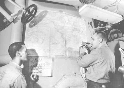
There were charts of "THE WORLD" (courtesy of National Geographic) plastered on various bulkheads, passageways and equipment throughout the boat during the circumnavigation. In this photo, Harry Marenbach (on the left) and Paul "Dutch" Schulze are checking our progress on the chart mounted on the DFT in AMR2. If you look at the calendar Harry's marking up, the date is 11 April 1960. And from where Dutch has got his marking pen, we're about 5 days from the Cape of Good Hope on the southern tip of Africa.
The charts were both a source of depression and exhilaration. The scale was 620 miles to the inch and after a long hard days run, we'd only gone about three-quarters of an inch! On top of that, the more you stared at that chart, the more you realized just how big the earth really was. And the better you understood the real meaning of Ned Beach's words when he announced over the 1MC, "We have the ship and we have the crew. We are going to go around the world, nonstop. And we're going to do it entirely submerged."